UPDATE: Most of WNY Under Marginal Severe Weather Risk
4/21/2025 7:27:55 AM
By Greg Larson, News Director
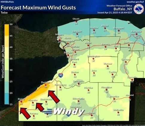
We're going to be in for a windy day today, especially in areas along and downwind of the Chautauqua Ridge. The National Weather Service in Buffalo has issued a wind advisory for Chautauqua County until 2:00 PM. According to meteorologist Aaron Reynolds, we'll see south to southeast winds 20-30 MPH, with gusts up to 50 MPH expected. He says the gusty winds will come out ahead of a cold front that that will bring showers and thunderstorms to the area...
Aaron Reynolds: showers and thunderstorms heading our way
Reynolds says travel will be difficult for high-profile vehicles along the I-90 corridor, where gusty crosswinds will occur...
Aaron Reynolds: difficult travel
In addition to the tricky travel, gusty winds may knock down some tree limbs and lead to some isolated power outages.
9:45 AM UPDATE: The National Weather Service's Storm Prediction Center has most of Western New York, including Chautauqua County, under a marginal risk for severe weather. Damaging wind gusts and marginally severe hail will be be the primary threats during the afternoon and early evening, with Chautauqua County also having a 2% chance of a tornado.