Cold Front to Cause Rapid Drop in Temperatures Today
2/28/2024 7:18:14 AM
By Greg Larson, News Director
It has been feeling like spring across Western New York, but that will change rapidly on Wednesday. Meteorologist Jon Hitchcock with the National Weather Service in Buffalo says temperatures across the region will be in the 60s before a strong cold front arrives by about midday. Hitchcock says that will lead to temperatures dropping by about 30 degrees during the course of the day...
Jon Hitchcock: cold front arriving by midday
While temperatures will drop below the freezing mark, Hitchcock says a flash freeze is not as likely as initially forecast earlier in the week. He says that's due to an anticipated lull in precipitation...
Jon Hitchcock: flash freeze less likely
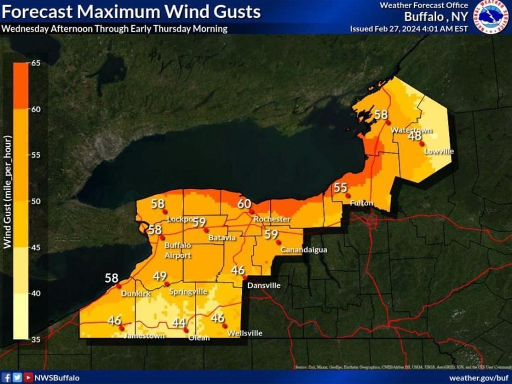
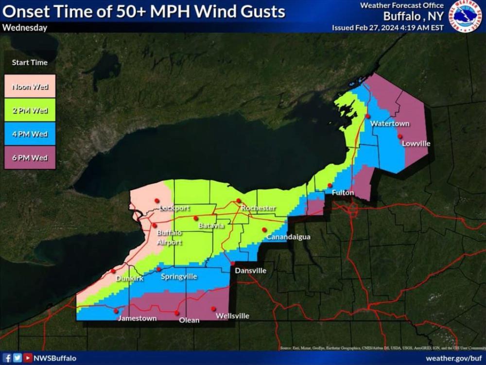
Meanwhile, the high wind watch for Chautauqua and Erie counties has been downgraded to a wind advisory, which begins at 11:00 AM and continues until 4:00 AM Thursday. Wind gusts up to 55 MPH are expected.