Warm, Humid Air Mass Could Trigger Severe Weather Through Wednesday
9/1/2026 6:49:52 AM
By Greg Larson, News Director
Western New York could see some unsettled over the next two days. Meteorologist Jon Hitchcock with the National Weather Service in Buffalo says a stalled frontal boundary, combined with the arrival of a warm and very humid air mass, will provide the fuel for potential severe thunderstorms on Tuesday and Wednesday. Hitchcock says any storms that develop on Tuesday will be spotty and isolated in nature...
Jon Hitchcock: storms will be spotty and isolated
Hitchcock says severe weather will be more likely across the region Wednesday afternoon and evening...
Jon Hitchcock: damaging winds will be the primary risk
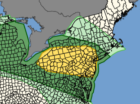
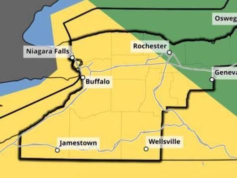
The National Weather Service's Storm Prediction Center has all of Western New York under a marginal to slight severe weather risk for both Tuesday and Wednesday. The entire western Southern Tier is under a slight severe weather risk for both days.
Top: Severe weather outlook for Tuesday. Bottom: Severe weather outlook for Wednesday. Areas under a slight severe weather risk are in yellow. Graphics by the National Weather Service